



AUSTIN, Texas — Millions of Texans remain under a rare high risk of flash flooding as another round of slow-moving thunderstorms drenches central and southwest Texas, prompting dozens of water rescues and raising fears of life-threatening flooding through the end of the week.
The Weather Prediction Center (WPC) has issued its highest Level 4 of 4 flood risk for parts of the Texas Hill Country, Edwards Plateau, and Rio Grande Valley for the second straight day. Forecasters warn that some communities could receive 10 inches or more of additional rainfall, with storms capable of producing 2 to 4 inches of rain per hour.
Rare Flood Warning Signals Serious Threat
Meteorologists say back-to-back “high risk” flood alerts are extremely uncommon, marking the first such event since April 2025.
“This is a significant to locally catastrophic flash flooding event,” the Weather Prediction Center warned, adding that flooded roads, overflowing rivers, and inundated homes are likely across the hardest-hit areas.
Officials said the danger is heightened because many locations had already received 6 to 12 inches of rain before the latest storms arrived, leaving the ground unable to absorb additional rainfall.
Dozens Rescued as Roads Disappear Under Water
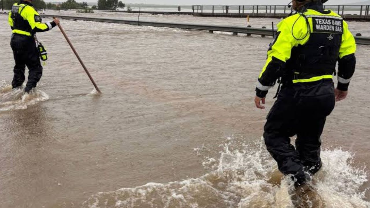
Emergency crews carried out widespread rescue operations Tuesday as floodwaters rapidly rose across south Texas.
In Uvalde County, at least 45 people were rescued from floodwaters after roads became impassable. The Uvalde Police Department said residents should “stay vigilant” as rivers, creeks, and drainage channels remain dangerously high.
Multiple additional water rescues were reported in neighboring Medina County, where floodwaters swept vehicles off roadways. Officials also confirmed that nearly 18 roads and one bridge became impassable due to rising water.
Disaster Declared Across 59 Texas Counties
Texas Governor Greg Abbott declared a disaster for 59 counties, allowing additional emergency resources to be deployed as severe flooding continues.
In announcing the declaration, Abbott said the heavy rainfall “poses a threat of imminent disaster, including widespread and severe property damage, injury or loss of life.“
Flood watches remain in effect for more than six million people, including residents in Austin, San Antonio, Del Rio, and San Angelo.
More Heavy Rain Expected Through Thursday
Forecasters say a stalled weather front interacting with deep Gulf moisture is creating an ideal setup for slow-moving thunderstorms capable of producing repeated rounds of intense rainfall.
The Weather Prediction Center expects the highest flood risk to continue through Thursday, with parts of southwest Texas remaining especially vulnerable. Localized flooding is also possible farther east, including areas near Houston.
Rainfall totals could exceed 10 inches in the hardest-hit communities, while Del Rio may receive more than 6 inches—roughly the amount of rain the city typically records during the entire summer.
Why Texas Hill Country Floods So Quickly
The Texas Hill Country remains one of the nation’s most flood-prone regions because of its steep terrain, shallow soils, and exposed limestone, which causes rainwater to run off rapidly instead of soaking into the ground.
Officials say those conditions, combined with already saturated soil, mean even moderate rainfall can quickly trigger dangerous flash flooding.
While forecasters expect rainfall to gradually decrease by Friday or Saturday, residents are urged to continue monitoring weather alerts and avoid driving across flooded roadways.
What are your thoughts on the repeated flooding emergencies in Texas? Should more investments be made in flood prevention and emergency preparedness? Share your thoughts respectfully in the comments below.