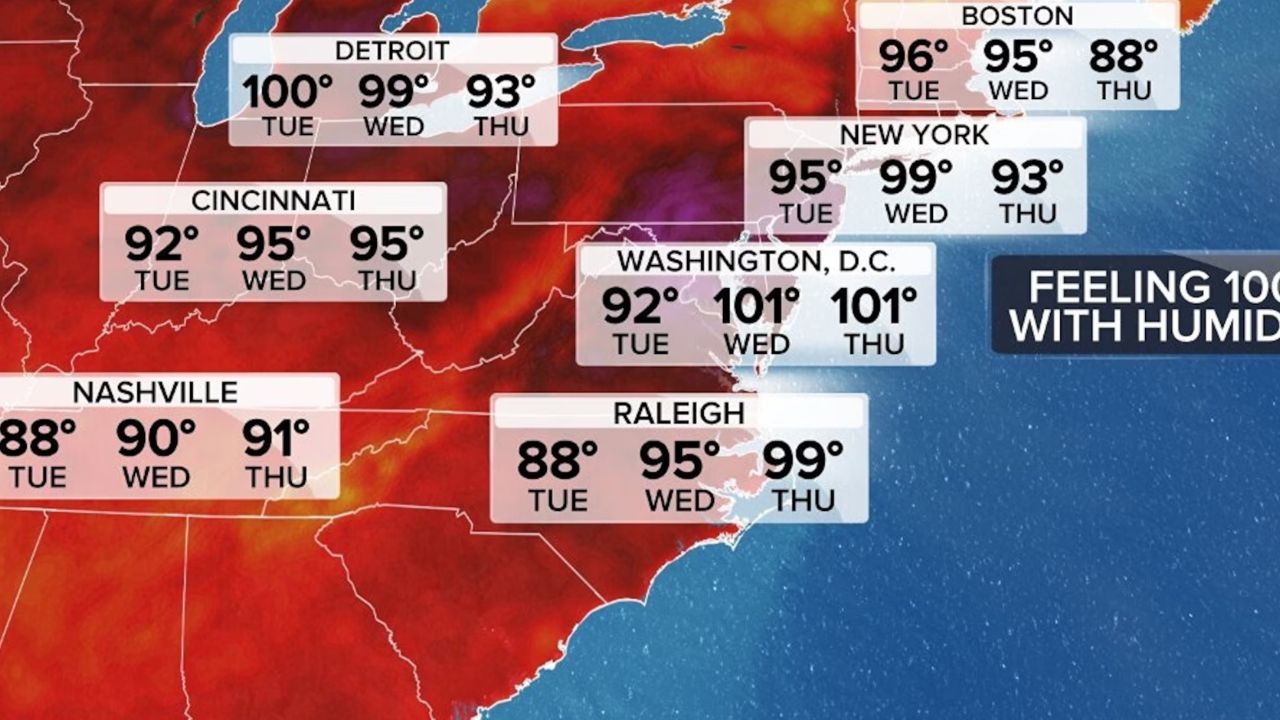





NEW YORK — A dangerous heat wave will continue gripping the New York City metropolitan area through Wednesday, with forecasters warning that the hottest conditions of the week could push the heat index above 100 degrees. Heat advisories remain in effect across New York City, Long Island, the Hudson Valley and parts of Connecticut, while portions of New Jersey are under an Extreme Heat Warning.
Officials are urging residents to limit outdoor activities, stay hydrated and check on vulnerable neighbors as high temperatures combine with oppressive humidity to create potentially dangerous conditions.
Heat Index Could Reach 107 Degrees
Wednesday is expected to be the peak of the ongoing heat wave, with actual temperatures climbing into the upper 90s. Factoring in humidity, however, it could feel as hot as 104 degrees across New York City and surrounding areas.
Conditions will be even more dangerous across central and southern New Jersey, where the heat index could reach 107 degrees under an Extreme Heat Warning in effect from 10 a.m. to 8 p.m.
Officials continue to remind residents that prolonged exposure to extreme heat can increase the risk of heat exhaustion and heat stroke.
“The combination of heat and humidity could create conditions that feel intolerable at times,” forecasters warned.
Rip Current and Air Quality Concerns
The dangerous weather extends beyond the extreme temperatures.
A high risk of rip currents remains in effect through Wednesday for beaches across New York City and Long Island. Lifeguards are urging swimmers to stay alert, as strong rip currents can quickly pull even experienced swimmers away from shore.
Meanwhile, air quality is also being closely monitored due to smoke drifting south from ongoing Canadian wildfires. An Air Quality Alert remains in effect through Tuesday night, and meteorologists say hazy skies are expected across much of the region.
If the wildfire smoke settles closer to the ground, officials say air quality could deteriorate further, especially for people with asthma or other respiratory conditions.
Cooler, Drier Weather Arrives Thursday
Relief is finally expected to arrive on Thursday as humidity levels begin to drop.
Although afternoon temperatures will still reach around 92 degrees, the lower humidity will make conditions feel considerably more comfortable compared to Wednesday. Friday is expected to remain warm with highs near 89 degrees under mostly dry conditions.
“A drier air mass will provide some welcome relief after several days of oppressive humidity,” forecasters said.
Weekend Storm Chances Return
The break from humidity will likely be short-lived.
Moisture is expected to return over the weekend, bringing an increasing chance of afternoon and evening thunderstorms beginning Saturday and continuing into Sunday. Some storms could become locally heavy, though meteorologists are continuing to monitor the forecast.
Weather conditions will also be closely watched ahead of the FIFA World Cup Final in East Rutherford, New Jersey, where large crowds are expected.
Looking ahead, Monday is forecast to be partly sunny before another chance of thunderstorms returns by Tuesday.
What are your thoughts on the latest heat wave affecting the Northeast? How are you staying safe during the extreme temperatures? Share your thoughts respectfully in the comments below.